The Old Town Sawahlunto, West Sumatra

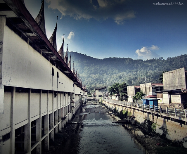
Sawahlunto is one of provinces in Indonesia, precisely in West Sumatera, Indonesia. This town is located in 95KM Northeast of Padang and surrounded by 3 districts in West Sumatera, which is Tanah Datar, Solok and Sijunjung. Sawahlunto is divided into 4 sub-districts and it has 273,45 km², with populated by 54.000 people. During Dutch civilization, Sawahlunto was popular as coal mining town. After being a death town, during the closing of the mining, Sawahlunto nowadays becomes the growing city with multi-ethnicity inside the community, and awarded as the best old…

Kerumutan Reserve Forest, Riau

This wildlife reserve forest is spread in an area of ??1,332,169 ha and it inhabited by many species of flora and fauna that typical of lowland forest. Its area of mangrove trees decorated corridor through the Kampar River, that made ??it so special among other forests which spread across the island of Sumatra. Kerumutan reserve forest is a conservation area that located in Kerumutan sub-district and spreading across two districts namely Pelalawan and Indragiri Hulu, Riau Province. The forest boundary is the River of Indragiri, Kampar River, the East Coast…

Sebesi Island, Lampung

Sebesi is an island in the Sunda Strait, between Java and Sumatra. It rises to a height of 844 metres (2,769 ft) and it lies about 12 kilometres (7.5 mi) north of the Krakatoa Islands; it is the closest large island to Krakatoa, about the same area and height as the remmant of Rakata. Like Krakatoa, it too is volcanic, although there are no dated eruptions known. Unlike the Krakatoas, Sebesi has permanent streams and is inhabited. Sebesi was devastated during the 1883 volcanic eruption of Krakatoa. Official records give…

Tebingtinggi Island – Riau

Tebing Tinggi Island Pulau Tebingtinggi or literally means high cliff island, is an island in Riau province, which is geographically located at latitude (0.9 degrees) 0° 54′ 0″ North of the Equator and longitude (102.75 degrees) 102° 45′ 0″ East of the Prime Meridian on the Map of the world. The locations related to Pulau Tebingtinggi are represented by the nearest distances for a beam of light to travel and may not be nearest by road. For example, Pulau Tebingtinggi, is located 11.7 kilometre from Selatpandjang, 11.7 kilometre from Selat…

Jemur Island – Riau

Jemur Island Jemur Island or Pulau Jemur is an island of Indonesia which is located in the Strait of Malacca, about 45 miles from capital of Rokan Hilir regency, Bagansiapiapi, and about 45 miles from Malaysia. This island is administratively part of Pasir Limau Kapas sub-district, Rokan Hilir regency,Riau province. Jemur islands are uninhabited and only a stopover place for fishermen who are to sea. A post of Indonesian Navy (TNI-AL) was established in this island for the purposes of observation and navigation. Currently, there is no accommodation in this…

Rupat Island – Riau

Rupat Island Rupat is an island in the Strait of Malacca, and administratively part of Bengkalis regency, Riau province. It lies just off the eastern coast of Sumatra, across from Dumai city, across the Strait of Rupat (Selat Rupat). Rupat was one of thousands of abandoned islands, but now the population is growing year after year, then it makes them expand the area for the settlement. This island is can be reached from Pekanbaru, Dumai or Bengkalis. The main transportation line from and to the island is by the sea.…

Natuna Archipelago, A Group Of Magnificent Islands in Indonesia

Natuna Islands Natuna Islands or Kepulauan Natuna is islands that consist of 272 islands, which located in the South China Sea in the larger Tudjuh Archipelago, off the northwest coast of Borneo. The islands is administratively a regency within the Riau Islands province and the Indonesia’s northernmost non-disputed island group. The Natuna islands are divided into three groups: North Natuna, which includes Laut Island (Pulau Laut); Central Natuna, which includes Natuna Besar; and South Natuna, which includes Subi Besar. Natuna is the most northern islands in the strait of Karimata.…

Magnificent Lingga Islands

Lingga Islands Lingga Islands or Lingga Archipelago are a group of islands in Indonesia, that located in the south of Singapore, along both sides of the equator, off the eastern coast of Riau Islands province, Sumatra. They are south of the populated Riau Archipelago, which known for the industrial island of Batam and the tourist-frequented island of Bintan, although the Lingga Islands themselves are rarely visited due to the infrequent local transportation. The equator goes through the northern tip of Lingga, the name of the main island in the archipelago.…

Karimun Islands, Riau

Kepulauan Karimun Kepulauan Karimun or Karimun islands is located in Karimun regency, Riau islands. Karimun regency is consists of 198 islands with 67 of them are inhabited. Tanjung Balai is the capital and the main town of Karimun Islands, and also becomes the busiest town in Riau Islands. Perhaps this is due to the fact that it is somewhat of a cross-road between Indonesia, Malaysia and Singapore. You can walk around and explore this town on your own or you can take the local transportation like bus, which is very…

Bengkalis Island – Riau

Bengkalis Island Bengkalis island is located in Riau province and part of Bengkalis regency. Pulau Bengkalis is uniformly covered with vegetation. The N coast is fronted by shallow ridges running parallel to it and separated by deeper channels. The village of Bantantengah lies about midway between Tanjung Jati and Tanjung Parit, the NE end of the island. During May and November numerous fishing boats frequent the waters N of the island. In Selat Bengkalis, the SE current begins about 2 hours after LW along the shore and may attain a…